We come to the last of the four original indigenous quarters of the Indian Republic of San Juan Tenochtitlan established by the Spanish, San Sebastián Atazacoalco, in the northeast corner of Centro.
In the 16th century, San Juan Moyotla was the most densely populated and so was made the ayuntamiento, government headquarters. San Pablo Teopan-Zoquipan was the largest in territory and strategically important as the southern gateway. Santa Maria Cuepopan was the site of significant battles between the Mexica and their neighbors and with the Spanish.
San Sebastián Atzacoalco was the smallest. It is also, perhaps, the least remembered, as it apparently retains the fewest significant landmarks from the period of the transformation of Tenochtitlan into Mexico City. The former Spanish parcialidad is now part of Centro North and Centro East.
San Sebastián: Venerating Martyrs
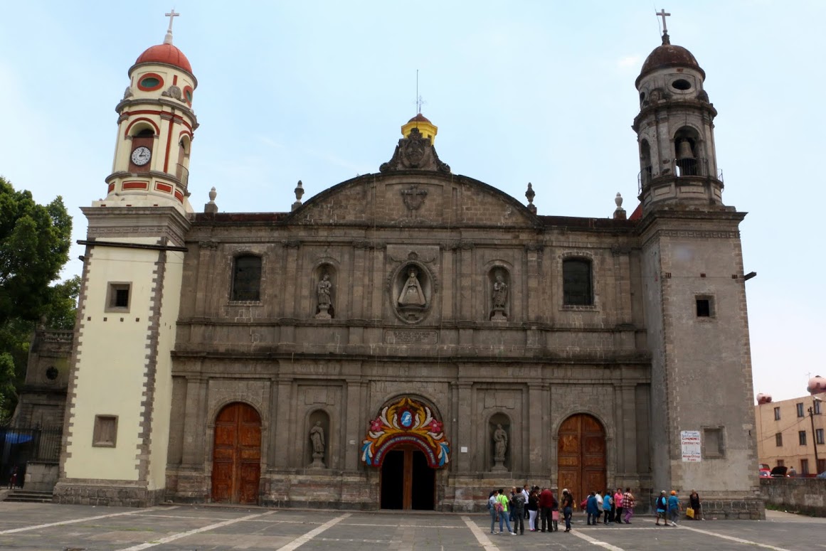
Using the original churches, plazas and markets as reference points for orienting our search, we head first for the Church of San Sebastián Martir Atzacoalco, about five blocks northeast of the Zócalo.
A simple building of tezontle, red volcanic stone, much like Santa María la Redonda in Cuepopan, the orginal church was built by the Franciscans under the direction of Fray Pedro de Gante, Friar Peter of Ghent in the early 16th century. In 1568, when pressures from other religious orders led the Pope to reassign some of the original four parcialdades, San Sebastián was given to the Carmelites. About forty years later, it was transferred to the Augustinians. Like other churches managed by the orders, in the 1770s, it was taken under the control of the Archbishop of Mexico City who assigned "secular", i.e., diocesan clergy.
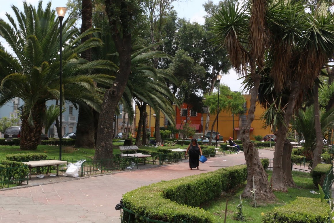
The church faces a plaza surrounded by colorfully painted Colonial era buildings and full of trees, neatly trimmed boxwood hedges (adopted from the Moorish gardens of Spain), benches and a bit too much refuse.
Inside, the church retains the simplicity of other early Franciscan churches.
We wonder about the Franciscan choice of San Sebastián as the patron saint for this church and this parcialidad. The choices for the other three sectors seem obvious: St. John the Baptist, St. Paul, the Virgin Mary. But why St. Sebastian, one of hundreds of other possible saints? We recall that three old churches in or near Coyoacán, where we live, are dedicated to this saint.
Saint Sebastián (died c. 288) was an early Christian saint and martyr. According to Christian belief, he was killed during the Roman Emperor Diocletian's persecution of Christians. He is commonly depicted in art and literature tied to a post or tree and shot with arrows. Despite this being the most common artistic depiction of Sebastian, he was, according to legend, rescued and healed by Irene of Rome. Shortly afterward, he publicly confronted Diocletian to warn him about his sins and, as a result, was clubbed to death. Wikipedia
We have to admit upfront that, having been raised as a Protestant with Puritan roots, we find it very hard to relate to these images of suffering and dead martyrs. Our childhhood church had a cross behind the Communion Table. It was empty, a rather abstract symbol of the death of Jesus. But the focus was always on the living Christ and how we should imitate him in our lives.
In Catholicism and in Mexico, it is different. The Mexican worldview is a dramatic one, full of protagonists and antagonists, heroes and villains, the forces of good versus the forces of evil, entangled in a lucha, a struggle for victory one over the other. An archetypical expression of this drama is its Catholic faith, with its martyrs.
As Lomnitz points out, this focus on death goes back to prehispanic indigenous cultures. Aztec culture was centered on waging wars of conquests and taking captives for sacrifice to its gods in order to maintain their favor.
In the Mesoamerican creation myths, the world we humans inhabit had been brought into existence by means of the sacrificial death of a god. Hence, sacrificial deaths of humans were necessary to keep the world going on. Blood fed the sun so that it had the energy to rise each new day from the world of darkness and travel across the sky, lighting and warming the human world. Dying as a warrior in battle or by sacrifice to the gods was life's highest attainment.
The Aztecs' answer to the human dilemma of mortality was to embrace death. Thus, representations of death, and of the gods who required it, were central to its symbolic creations. The museum of the Templo Mayor, just a few short blocks south of San Sebastián Martir, is full of such symbols, unearthed from around and within the many-layered pyramid.
So, when the Franciscans came to Nueva España to convert the Mexica and the many other indigenous peoples of what we now refer to as Mesoamerica, their faith, centered on sacrifice, martydom, death and resurrection, was sown in a fertile field. Actual blood sacrifice was no longer allowed, but it also was unnecessary in the new belief system of the Gospel, the Good News.
Christ, the very Son of God himself, had sacrificed himself once, for all humankind. Participation in that sacrifice became symbolic, in the Mass and the consuming of the Host, the Body of Christ. And it became symbolically represented in the many images of the persecuted and crucified Christ and martyrs such as San Sebastián.
Our Lady of Solitude
So we leave San Sebastián Martir, wondering where all this suffering and death might lead. The faith says it leads to Resurrection, a new, eternal life in a Heaven beyond this world. But, we ask, how does that manifest itself in the everyday life of Catholic Mexicans here on Earth, even more specifically, here in the barrios of Mexico City?
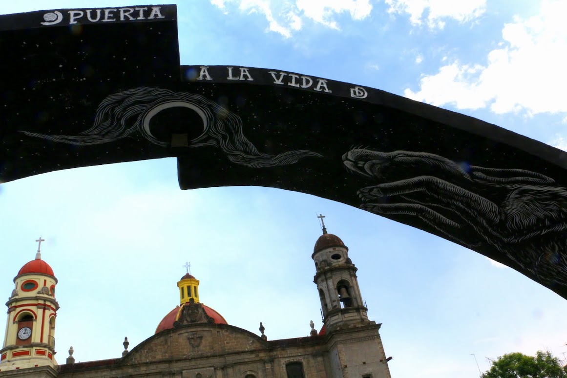
Our next stop is a church on the east side of the Anillo, the Ringroad that marks the eastern boundary of Centro and the Delegación, Borough, of Cuauhtémoc, but which apparently wasn't quite the eastern boundary of Atzacoalco.
La Iglesia de Santa Cruz y la Virgen de Soledad, the Church of the Holy Cross and the Virgin of Solitude, better known simply as La Soledad, is, like virtually all the other churches visited in our search, the second one built on the site. The original church was dedicated to Santa Cruz, the Holy Cross. It was under the tenure of the Augustinians from 1633 to 1750, serving indigenous residents of the southern part of Atzacoalco.
As with all the other churches of the religious orders, the Agustinians were removed in the mid-1700s and replaced by diocesan clergy. The church was then rebuilt in Neo-classical style and finished in 1787. It was dedicated to la Virgen de la Soledad, the Virgin of Solitude. Wikipedia
There is a plaza in front of the church, but it is mostly a paved, barren space, with some benches occupied on the day of our visit by men who seemed to have nothing else to do, a rare thing in Mexico, where every able-bodied adult engages in some form of work, even if it means selling something on the streets or washing car windshields at intersections. The buildings around the plaza seem equally devoid of usefulness.
However, in the center of the plaza there is a free-standing arch of black steel, evidently a fairly recent addition.
The Door to Life is a striking artistic statement. When you stand in front of it, it frames La Soledad. as if to say, "This is the Way," but the symbols on its underside imply something different. Two large rabbits seem to be leaping towards the moon, set in the night sky. In Mesoamerican mythology, the face of the full moon was seen as a rabbit. The Milky Way was the path to Heaven. So is this a case of "religious syncretism", the blending of indigenous and Christian beliefs? Or is it a message of an alternative path? There is no signage to answer our question or tell us who placed the arch in the Plaza of Solitude.
We are also struck by how crossing the Anillo from the west side to the east has brought us from one world to another, from a bustling neighborhood of working class shops and street puestos virtually identical to La Merced neighborhood just a few blocks to the south, to an apparently poorer barrio, with few open shops and few people on the streets, except for the unoccupied men on the plaza's benches.
The portada portrays St. Anthony of Padua (1195-1231) in his most common pose, holding the Child Jesus. Anthony was originally a Portugese Augustinian monk who became a Franciscan shortly after that order was founded in 1209 by Francis of Assisi. He became known for his powerful preaching and for his compassion for the poor. He is also a saint for lost people and things. We learned later that June 13, the week following our visit, was his saint's day. Hence, the retablo.
Traditionally, such portadas created for saint's days are made of real flowers. In recent times, these are often replaced by ones made of plastic flowers, like the one we saw at nearby La Soledad. Like artificial Christmas trees, they have longevity and are far cheaper. This one is made, instead, of natural plant materials, including bark, woven palm fronds, cane and other fibers, so it is both "real" and long-lasting. We have seen similar constructions in provincial pueblos. It is artesenal, handcrafted. Much labor and much care were invested to construct it. So, all in all, the ambience is one of a village church somewhere in the hinterlands of Mexico, not the capital city with its millions.
In the 16th century, San Juan Moyotla was the most densely populated and so was made the ayuntamiento, government headquarters. San Pablo Teopan-Zoquipan was the largest in territory and strategically important as the southern gateway. Santa Maria Cuepopan was the site of significant battles between the Mexica and their neighbors and with the Spanish.
San Sebastián Atzacoalco was the smallest. It is also, perhaps, the least remembered, as it apparently retains the fewest significant landmarks from the period of the transformation of Tenochtitlan into Mexico City. The former Spanish parcialidad is now part of Centro North and Centro East.
 |
Four Ancient Barrios of Tenochtitlan
Located on Map of Present-day Mexico City
Small Black Square: Templo Mayor
San Sebastián is upper right.
North: North Axis 1 (Granaditas/Jardineros) West: Argentina/Jesús Carranza Street East: Axis 1 East or Congreso de la Unión South: Corregidora |
San Sebastián: Venerating Martyrs
Using the original churches, plazas and markets as reference points for orienting our search, we head first for the Church of San Sebastián Martir Atzacoalco, about five blocks northeast of the Zócalo.
 |
| Church of San Sebastián Martir Atzacoalco |
A simple building of tezontle, red volcanic stone, much like Santa María la Redonda in Cuepopan, the orginal church was built by the Franciscans under the direction of Fray Pedro de Gante, Friar Peter of Ghent in the early 16th century. In 1568, when pressures from other religious orders led the Pope to reassign some of the original four parcialdades, San Sebastián was given to the Carmelites. About forty years later, it was transferred to the Augustinians. Like other churches managed by the orders, in the 1770s, it was taken under the control of the Archbishop of Mexico City who assigned "secular", i.e., diocesan clergy.
 |
| Plaza in front of San Sebastián Martir |
The church faces a plaza surrounded by colorfully painted Colonial era buildings and full of trees, neatly trimmed boxwood hedges (adopted from the Moorish gardens of Spain), benches and a bit too much refuse.
Inside, the church retains the simplicity of other early Franciscan churches.
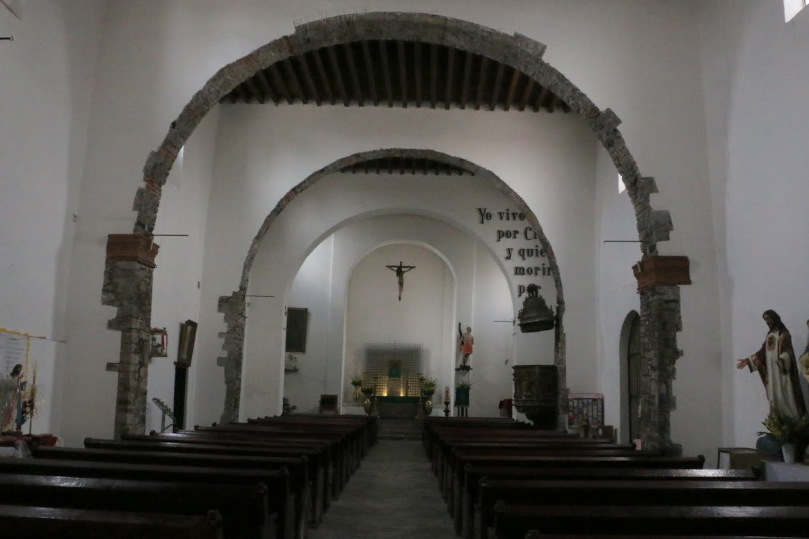 |
| Simple interior |
Why Martyrs?
We wonder about the Franciscan choice of San Sebastián as the patron saint for this church and this parcialidad. The choices for the other three sectors seem obvious: St. John the Baptist, St. Paul, the Virgin Mary. But why St. Sebastian, one of hundreds of other possible saints? We recall that three old churches in or near Coyoacán, where we live, are dedicated to this saint.
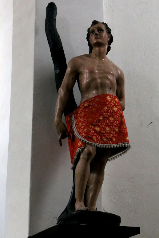 |
| San Sebastián Martir |
Saint Sebastián (died c. 288) was an early Christian saint and martyr. According to Christian belief, he was killed during the Roman Emperor Diocletian's persecution of Christians. He is commonly depicted in art and literature tied to a post or tree and shot with arrows. Despite this being the most common artistic depiction of Sebastian, he was, according to legend, rescued and healed by Irene of Rome. Shortly afterward, he publicly confronted Diocletian to warn him about his sins and, as a result, was clubbed to death. Wikipedia
 |
| Crucified Christ |
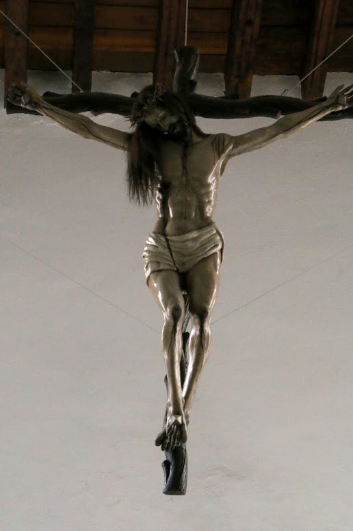
Above the altar hangs a cross with the crucified Christ, the martyr on whom the Christian faith is founded. Other images of suffering or dead martrys populate the sanctuary, as they do in virtually every Catholic Church in Mexico.
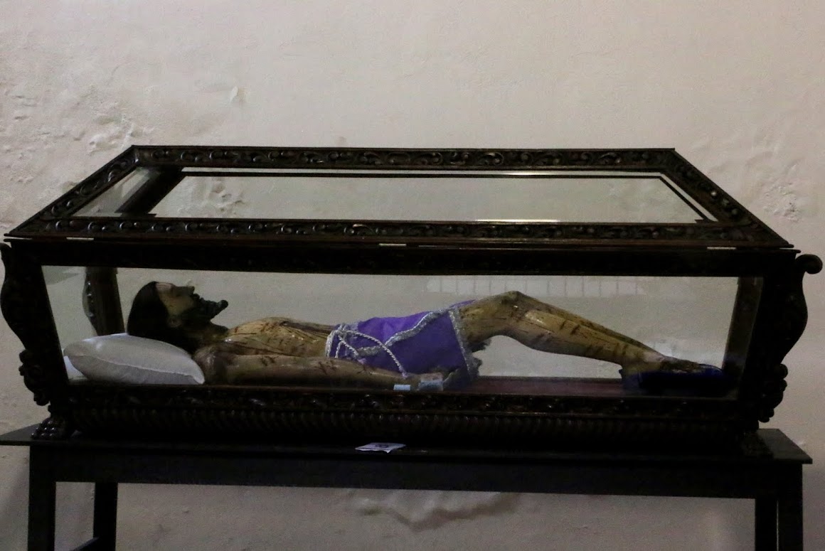 |
| Christ enterrado, interred, buried |
We have to admit upfront that, having been raised as a Protestant with Puritan roots, we find it very hard to relate to these images of suffering and dead martyrs. Our childhhood church had a cross behind the Communion Table. It was empty, a rather abstract symbol of the death of Jesus. But the focus was always on the living Christ and how we should imitate him in our lives.
In Catholicism and in Mexico, it is different. The Mexican worldview is a dramatic one, full of protagonists and antagonists, heroes and villains, the forces of good versus the forces of evil, entangled in a lucha, a struggle for victory one over the other. An archetypical expression of this drama is its Catholic faith, with its martyrs.
Symbols of Death in Mexico
Chilean-born, Mexican-educated anthropologist and naturalized Mexican citizen, Claudio Lomnitz, maintains that a particular view and representation of death is a central “totem,” or symbol, that holds Mexican identity together. In his book, Death and the Idea of Mexico, he reviews the long history of Mexican representations and beliefs about death as central to how life is to be understood and lived.
While in life, the world may be divided between los de arriba and los de abajo, those above versus those below, the wealthy versus the working class and poor, when Death arrives, she makes all humans equals. Death, or at least the images of death—the calaveras (skulls) and Catrinas (skeletal figures dressed as elegant ladies or other characters)—is played with sardonically. Life is a Dance with Death, which she leads and brings to an end.
While in life, the world may be divided between los de arriba and los de abajo, those above versus those below, the wealthy versus the working class and poor, when Death arrives, she makes all humans equals. Death, or at least the images of death—the calaveras (skulls) and Catrinas (skeletal figures dressed as elegant ladies or other characters)—is played with sardonically. Life is a Dance with Death, which she leads and brings to an end.
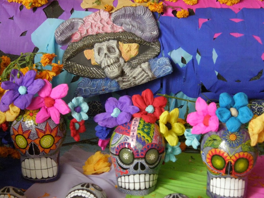 |
| Catrina, Lady Death, and calaveras, skulls Day of the Dead celebration, Coyoacán |
As Lomnitz points out, this focus on death goes back to prehispanic indigenous cultures. Aztec culture was centered on waging wars of conquests and taking captives for sacrifice to its gods in order to maintain their favor.
In the Mesoamerican creation myths, the world we humans inhabit had been brought into existence by means of the sacrificial death of a god. Hence, sacrificial deaths of humans were necessary to keep the world going on. Blood fed the sun so that it had the energy to rise each new day from the world of darkness and travel across the sky, lighting and warming the human world. Dying as a warrior in battle or by sacrifice to the gods was life's highest attainment.
The Aztecs' answer to the human dilemma of mortality was to embrace death. Thus, representations of death, and of the gods who required it, were central to its symbolic creations. The museum of the Templo Mayor, just a few short blocks south of San Sebastián Martir, is full of such symbols, unearthed from around and within the many-layered pyramid.
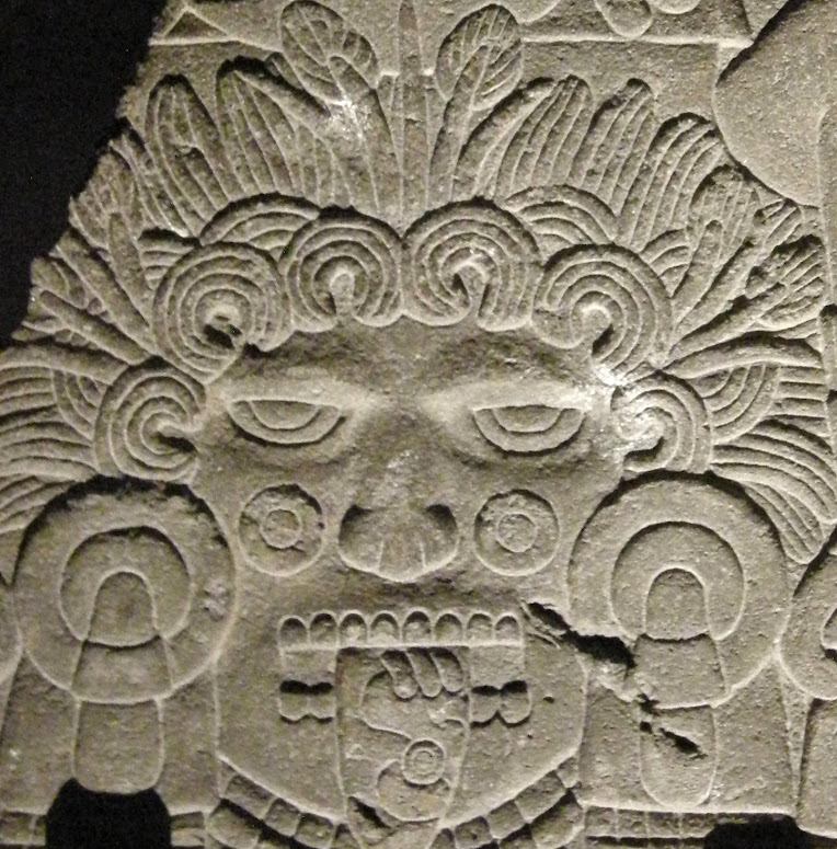 |
| Tonatiuh, Sun God His tongue is a sacrificial knife, as he required daily blood sacrifice to rise and cross the sky. |
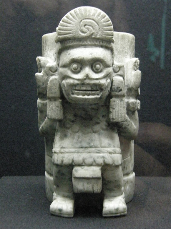 |
| Mictlantecuhtli, God of the Underworld, Realm of the Dead |
So, when the Franciscans came to Nueva España to convert the Mexica and the many other indigenous peoples of what we now refer to as Mesoamerica, their faith, centered on sacrifice, martydom, death and resurrection, was sown in a fertile field. Actual blood sacrifice was no longer allowed, but it also was unnecessary in the new belief system of the Gospel, the Good News.
Christ, the very Son of God himself, had sacrificed himself once, for all humankind. Participation in that sacrifice became symbolic, in the Mass and the consuming of the Host, the Body of Christ. And it became symbolically represented in the many images of the persecuted and crucified Christ and martyrs such as San Sebastián.
Our Lady of Solitude
So we leave San Sebastián Martir, wondering where all this suffering and death might lead. The faith says it leads to Resurrection, a new, eternal life in a Heaven beyond this world. But, we ask, how does that manifest itself in the everyday life of Catholic Mexicans here on Earth, even more specifically, here in the barrios of Mexico City?
Our next stop is a church on the east side of the Anillo, the Ringroad that marks the eastern boundary of Centro and the Delegación, Borough, of Cuauhtémoc, but which apparently wasn't quite the eastern boundary of Atzacoalco.
 |
| Church of Santa Cruz y La Virgen de Soledad Seen from across the Anillo, the Ringroad, a one-way avenue built in the 1950s. |
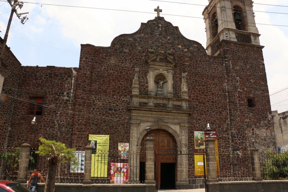
La Iglesia de Santa Cruz y la Virgen de Soledad, the Church of the Holy Cross and the Virgin of Solitude, better known simply as La Soledad, is, like virtually all the other churches visited in our search, the second one built on the site. The original church was dedicated to Santa Cruz, the Holy Cross. It was under the tenure of the Augustinians from 1633 to 1750, serving indigenous residents of the southern part of Atzacoalco.
As with all the other churches of the religious orders, the Agustinians were removed in the mid-1700s and replaced by diocesan clergy. The church was then rebuilt in Neo-classical style and finished in 1787. It was dedicated to la Virgen de la Soledad, the Virgin of Solitude. Wikipedia
 |
| Church of Santa Cruz y La Soledad A Neo-classic version of a Roman basilica. The Virgin of Solitude stands above the center door. Note the traditional indigenous-inspired floral arc over the doorway. |
There is a plaza in front of the church, but it is mostly a paved, barren space, with some benches occupied on the day of our visit by men who seemed to have nothing else to do, a rare thing in Mexico, where every able-bodied adult engages in some form of work, even if it means selling something on the streets or washing car windshields at intersections. The buildings around the plaza seem equally devoid of usefulness.
However, in the center of the plaza there is a free-standing arch of black steel, evidently a fairly recent addition.
 |
| Door to Life |
The Door to Life is a striking artistic statement. When you stand in front of it, it frames La Soledad. as if to say, "This is the Way," but the symbols on its underside imply something different. Two large rabbits seem to be leaping towards the moon, set in the night sky. In Mesoamerican mythology, the face of the full moon was seen as a rabbit. The Milky Way was the path to Heaven. So is this a case of "religious syncretism", the blending of indigenous and Christian beliefs? Or is it a message of an alternative path? There is no signage to answer our question or tell us who placed the arch in the Plaza of Solitude.
We are also struck by how crossing the Anillo from the west side to the east has brought us from one world to another, from a bustling neighborhood of working class shops and street puestos virtually identical to La Merced neighborhood just a few blocks to the south, to an apparently poorer barrio, with few open shops and few people on the streets, except for the unoccupied men on the plaza's benches.
 |
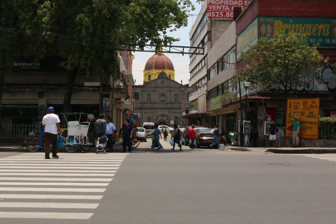
| Looking West from the Ringroad, along Calle Soledad toward the National Palace; Torre Latinoamerica rises beyond the Zócalo |
As we know from having lived in New York City, crossing a street can take you from one world to another, from one full of life to one barely hanging on.
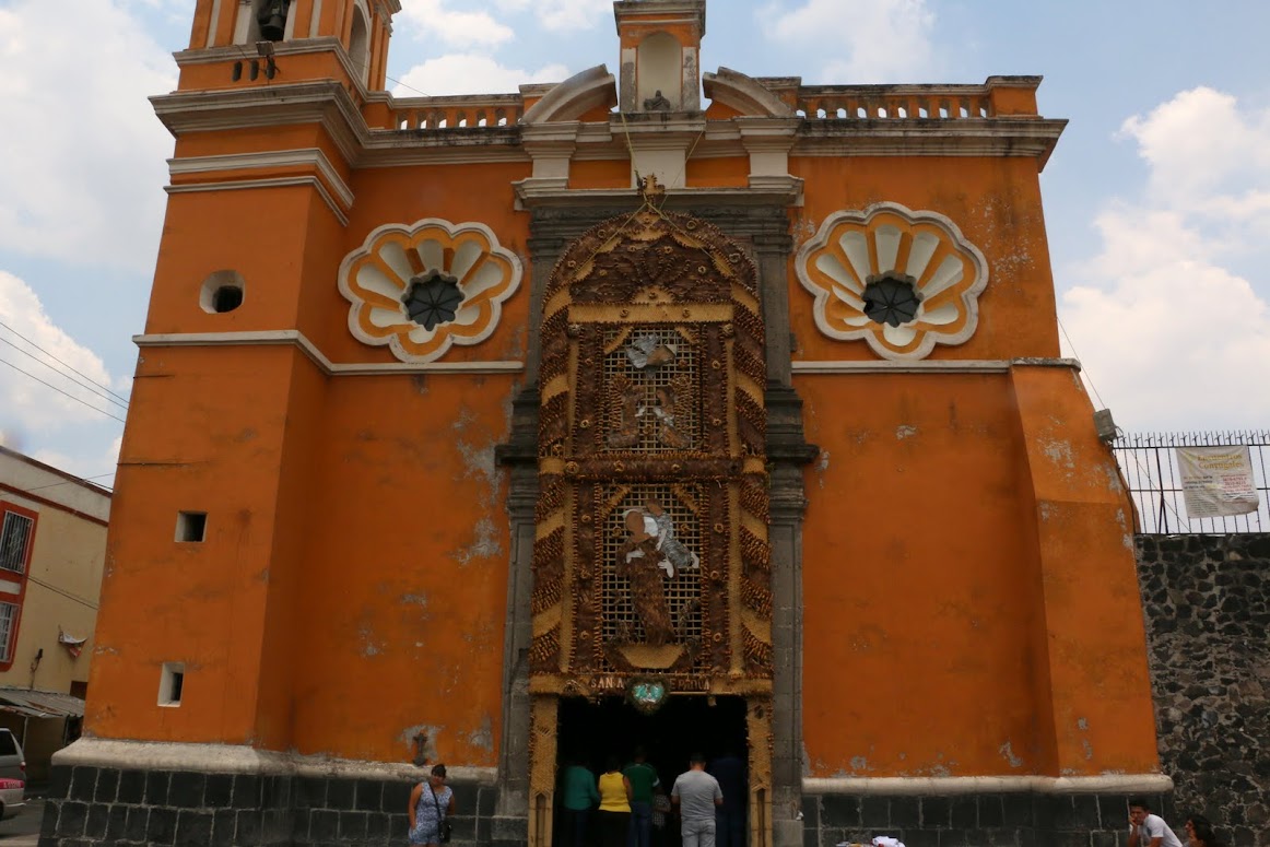
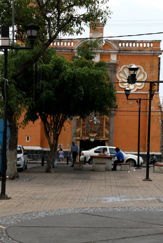
San Antonio de Padua Tomatlán: Provincial Village in the City
Our next stop is also east of the Ringroad, three short blocks north. Because of lack of time and energy, we postpone our visit to another day. When we go, it is a Sunday. Calle San Antonio Tomatlán is also virtually empty, the shops shuttered behind their solid steel gates. We wonder if they are abandoned or simply closed for the day. One shop is open, a panadería, a bread shop. We wait while the woman owner takes care of a customer before asking about the closed shops. "Oh," she replies, "they're always closed on Sunday."
Initially, this makes sense to us. It is el domingo, the Lord's Day. but we know that just a few blocks south, most every shop is open and the streets are full of vendors hawking their wares in full voice. We wonder why the difference from one barrio to the next. Is this a more traditional one?
 |
| San Antonio de Padua Tomatlán, faces a small plaza |
San Antonio de Padua Tomatlán, St. Anthony of Padua, Tomatlán, is notably different in architectural style from both San Sebastián Atzacoalco´s almost severe stone and white plaster simplicity and La Soledad's Neo-classic grandeza, grandeur. Its facade is a simple rectangle, with a Neo-classic arch and columns framing the door. Its plastered walls are painted a soft orange, typical of Mexican colonial buildings in las provincias, the provinces, i.e., cities and towns outside Mexcio City. Two large folk-style "flowers", surrounding small windows high above, add to the povincial flavor.
Carrying this folk aesthetic even further is the "portada", the display above the portal, the entrance.
 |
| San Antonio de Padua, holding el Niño Jesús, the Child Jesus |
The portada portrays St. Anthony of Padua (1195-1231) in his most common pose, holding the Child Jesus. Anthony was originally a Portugese Augustinian monk who became a Franciscan shortly after that order was founded in 1209 by Francis of Assisi. He became known for his powerful preaching and for his compassion for the poor. He is also a saint for lost people and things. We learned later that June 13, the week following our visit, was his saint's day. Hence, the retablo.
Traditionally, such portadas created for saint's days are made of real flowers. In recent times, these are often replaced by ones made of plastic flowers, like the one we saw at nearby La Soledad. Like artificial Christmas trees, they have longevity and are far cheaper. This one is made, instead, of natural plant materials, including bark, woven palm fronds, cane and other fibers, so it is both "real" and long-lasting. We have seen similar constructions in provincial pueblos. It is artesenal, handcrafted. Much labor and much care were invested to construct it. So, all in all, the ambience is one of a village church somewhere in the hinterlands of Mexico, not the capital city with its millions.
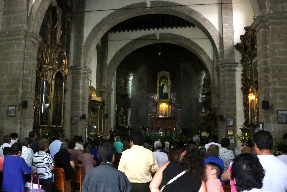
Inside, the sancturary is full. It is Sunday one o'clock Mass. The congregation appears to be composed of "ordinary" working class Mexicans of all ages. The structure, itself, is a mixture of simple stone Romanesque arches, the unadorned white plaster of Franciscan chapels and 18th century guilded Baroque side-altars. The retablo behind the altar is a simpler version of the natural one outside, just polished wooden strips. The overall sense is of a cross-section of the three centuries of Colonial Spanish rule, mixed with the Mexican countryside, all in a contemporary inner-city barrio.
The Church of San Antonio Tomatlán is of indefinite age. The indigenous "apellido", last name, indicates its origins serving an indigenous barrio. One source we found lists it among the original churches built by the Franciscans in the 16th century. Another source said there is no record of it until two hudred years later, in the 18th century. The Baroque side altars and the Neoclassic entrance speak of 18th century modifications to its otherwise simple aesthetic. We also learn that the plaster surface of the exterior is a recent restoration. Previously, the facade was bare tezontle stone, like San Sebastián Martir.
Mi Pueblo: Family and Community, Life and Hope
In any case, the parish of San Antonio Tomatlán appears to be alive and well. Many Catholic church Masses are not heavily attended. A 2013 survey found that 85% of Mexicans identify as Catholics but half said they attend Mass less than once a month. Forty percent have not gone to Confession in five years. Only 28% are of the opinion that the teachings of the Church should be believed word for word. Just 15% say their family life involves a high level of religious commitment. A majority say family is most important. All of this, except perhaps the commitment to family, sounds like global post-modern culture.
Whatever may be the percentage of residents of the barrio of Tomatlán attending Mass at San Antonio, at least a fair number still participate in the rituals of the Church, whether out of religious belief or, as implied in the statistics, primarily to maintain a family and community cultural tradition.
Mexicans are a culture traditionally based in extended family and commuity relationships. Mi pueblo, means both "my village" and "my people". In cities, barrios, small neighborhoods such as Tomatlán, are the equivalent of mi pueblo. As we have learned in our research of the four parcialidades of the Indian Republic of San Juan Tenochtitlan, they were continuations of the Mexica campan, quadrants or quarters, with their subdivisions into calpultin, barrios, composed of clans, i.e., extended family groups.
We recall how a Purépecha artisan we came to know in the pueblo of Tócuaro on Lake Pátzcuaro, when graciously hosting us in her home for the village patron saint fiesta, told us that the pueblo was divided into four quarters and how those living in her quarter were familiares, relatives. Our Spanish teacher in Pátzucaro, a small city of about 50,000, walking through the plaza where her family ran a puesto in the mercado, would point out all her "tias y primos", aunts and cousins (including what we would call second and third cousins, if we were ever to keep track of them the way our grandparents did). She also commented that she never felt alone; she always had her family and the patron saint of her birthday with her. She and her family are Catholic, but don't go to Mass.
So Mexicans "belong" to their family and community before all else. While that family culture may be less and less overtly Catholic, it is still implicitly so. Community life, at least in small pueblos and towns, is pervaded with Catholic religious imagery and rituals. San Antonio Tomatlán gives us a glimpse that this is also true in the original barrios of Mexico City.
It is in these barrios populares that "el pueblo", the ordinary, working class people, live. And it is through continuation of the Catholic rituals established in each one of them by the friars some five hundred years ago that they maintain a continuity in their sense of ethnic identity. While the Spanish Conquest attacked them physically and overthrew them politically, the "Spiritual Conquest" provided a way to survive as a people psychologically and culturally.
Begun by the Franciscans here, in the barrios of San Juan Tenochtitlan, that second conquest removed temples, priests, images of gods and the rituals attached to them, but it also provided replacements for each of those components of religion and culture. Thus, while transforming communal and, within that, individual identity, it also made possible the continuation of both, and of the intimate bonds between them.
The identity of each barrio and its pobladores, residents, like all human identities, consists of two complementary dimensions. On one side, there is an individual distinctiveness marked in each barrio, now a parish, by its patron saint and his or her annual fiesta. On the other side, there are bonds with the larger culture through a common system of meaning embodied in shared symbols and rituals.
With that identity, the members of el barrio, el pueblo, can go on living their "ordinary" lives, with all the struggles entailed. They can go on living, nurtured by their communal experience and, therefore, by the hope that, while their individual fate is always the same—Death will come and take them away—their family and communal life will go on.
It is these barrios, these pueblos originarios, and their individual and shared identities, that we will continue to explore.
Whatever may be the percentage of residents of the barrio of Tomatlán attending Mass at San Antonio, at least a fair number still participate in the rituals of the Church, whether out of religious belief or, as implied in the statistics, primarily to maintain a family and community cultural tradition.
Mexicans are a culture traditionally based in extended family and commuity relationships. Mi pueblo, means both "my village" and "my people". In cities, barrios, small neighborhoods such as Tomatlán, are the equivalent of mi pueblo. As we have learned in our research of the four parcialidades of the Indian Republic of San Juan Tenochtitlan, they were continuations of the Mexica campan, quadrants or quarters, with their subdivisions into calpultin, barrios, composed of clans, i.e., extended family groups.
We recall how a Purépecha artisan we came to know in the pueblo of Tócuaro on Lake Pátzcuaro, when graciously hosting us in her home for the village patron saint fiesta, told us that the pueblo was divided into four quarters and how those living in her quarter were familiares, relatives. Our Spanish teacher in Pátzucaro, a small city of about 50,000, walking through the plaza where her family ran a puesto in the mercado, would point out all her "tias y primos", aunts and cousins (including what we would call second and third cousins, if we were ever to keep track of them the way our grandparents did). She also commented that she never felt alone; she always had her family and the patron saint of her birthday with her. She and her family are Catholic, but don't go to Mass.
So Mexicans "belong" to their family and community before all else. While that family culture may be less and less overtly Catholic, it is still implicitly so. Community life, at least in small pueblos and towns, is pervaded with Catholic religious imagery and rituals. San Antonio Tomatlán gives us a glimpse that this is also true in the original barrios of Mexico City.
It is in these barrios populares that "el pueblo", the ordinary, working class people, live. And it is through continuation of the Catholic rituals established in each one of them by the friars some five hundred years ago that they maintain a continuity in their sense of ethnic identity. While the Spanish Conquest attacked them physically and overthrew them politically, the "Spiritual Conquest" provided a way to survive as a people psychologically and culturally.
Begun by the Franciscans here, in the barrios of San Juan Tenochtitlan, that second conquest removed temples, priests, images of gods and the rituals attached to them, but it also provided replacements for each of those components of religion and culture. Thus, while transforming communal and, within that, individual identity, it also made possible the continuation of both, and of the intimate bonds between them.
 |
| Fiesta in Pueblo Candelaria, Coyoacán Virgen de Candelaria, with additional saints We will get there in the near future. |
The identity of each barrio and its pobladores, residents, like all human identities, consists of two complementary dimensions. On one side, there is an individual distinctiveness marked in each barrio, now a parish, by its patron saint and his or her annual fiesta. On the other side, there are bonds with the larger culture through a common system of meaning embodied in shared symbols and rituals.
With that identity, the members of el barrio, el pueblo, can go on living their "ordinary" lives, with all the struggles entailed. They can go on living, nurtured by their communal experience and, therefore, by the hope that, while their individual fate is always the same—Death will come and take them away—their family and communal life will go on.
It is these barrios, these pueblos originarios, and their individual and shared identities, that we will continue to explore.
Series on Mexico City's Original Indigenous Villages:
- Landmarks of the Spiritual Conquest
- Tepeyac and the Virgin of Guadalupe
- Centro's Four Indigenous Quarters - Introduction
- The Franciscans - Where It All Began
- Centro's Four Original Indigenous Quarters: San Juan Moyotla
- Centro's Four Indigenous Quarters: San Pablo Teopan-Zoquipan, Part I - Crossroads
- Centro's Four Indigenous Quarters: San Pablo Teopan-Zoquipan Part II - Southern Gateway
- Centro's Four Indigenous Quarters: San Pablo Teopan-Zoquipan - Part III, La Merced
- Centro's Four Indigenous Quarters: Santa María Cuepopan - Battleground and Sacred Ground


