Wednesday, December 8, 2021

Welcome to Mexico City Ambles: Navigating the Blog

Welcome to Mexico City Ambles! Here we seek to present "el imaginario", a vision of the city as embodied in its cityscape, public art and neighborhoods (pueblos and colonias). Over time, as we sought to discover the physical and historical breadth and depth of the City, our search led us to focus on the life of its lesser-known, working-class neighborhoods, many of which were indigenous pueblos existing long before the Spanish arrived and took over 500 years ago. We visit these original pueblos when they are celebrating their traditional fiestas, which are lively, colorful celebrations of their centuries-long communal continuity and unique identity.

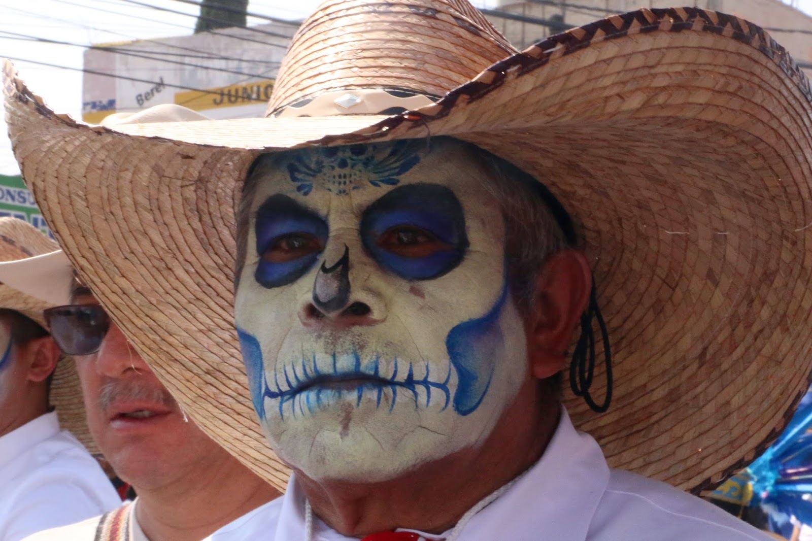
¡Bienvenido a Paseos por la Ciudad de México! Aquí buscamos presentar el imaginario, una visión de la ciudad como encarnada en su paisaje urbano, arte público, pueblos y colonias. Si bien buscamos cubrir la amplitud y profundidad física e histórica de la ciudad, nos ha llevado a centrarnos en en la vida de sus pueblos y barrios menos conocidos, muchos de los cuales eran pueblos indígenas que existían mucho antes de que los españoles llegaron y se hicieron cargo desde 500 años. Visitamos estos pueblos originales cuando celebran sus fiestas tradicionales, que son celebraciones coloridas y animadas de su continuidad comunal por siglos y su identidad única.

Escribimos en inglés porque somos norteamericanos y para dar a conocer a otros norteamericanos y hablantes de inglés la ciudad más allá de los lugares turisticos típicos. Sin embargo, es fácil traducir una página en español: vaya a la columna a la derecha. En la parte más alta hay una ventana etiquetada "Translate". Desplace la flecha abajo hasta encuentra "Spanish". Click en ese y inmediatamente todo el texto estará traducido en español por Google. Con certeza, habrá varios errores, pero creemos qué el sentido se quede bastante claro.  

Organization of the Blog
  • Each post appears in the blog chronologically by publication date. 
  • Scrolling down from this introduction takes you to the most recently published post. 
  • Most posts, however, have thematic or geographic connections to other posts. 
  • So, as a navigation aid, we have created individual PAGES (listed in the left-hand column) which organize posts according to major aspects of the city or themes in its history. 
  • These pages provide short descriptions of posts, grouped according to a theme or by geography, with links to all relevant, individual posts.

Setting the Stage | Introductory Pages:


I. Making Sense of Mexico City: The first four pages acquaint you with Mexico City's organization (it does have one, despite its apparent chaotic appearance).
  1. First, we introduce you to its sixteen alcaldías (literally "mayoralties", each governed by an elected alcalde, mayor, and a council) into which the city is divided spatially and politically. 
    The name, alcaldía, was assigned recently, in 2016, when the self-governing legal entity of la Ciudad de México, Mexico City, was established. Initially created in 1928, they were called delegaciones (we use that term in our early posts). They were the components of el Distrito Federal, the Federal District, governed by the federal administration until 2000. The closest English equivalent for these divisions is "boroughs". Each one is distinctive in its physical characteristics, population, and history.

    2. We then address why Mexico City architecture appears to the visitor to be such a hodgepodge of historical epochs and we present a way to view it as a horizontal archeological site, one of multiple eras sitting right next to one another. 

    3. Then we present the history of how the city grew from a small, Spanish Colonial city on an island in the midst of a huge lake to its present huge size (at 573 sq. miles, slightly smaller than Houston [599] but bigger than Los Angeles [469]!). 

    4. Finally, we describe el Metro, the "subway", which is the fastest and cheapest pathway (US25 cents) to get to most of the places we explore. If you avoid morning and late afternoon rush hours, it's fine. Taxis, both pink and white "libres" cruising the streets and white "taxis de sitio" (i.e. waiting at a taxi stand), are licensed, plentiful and safe. Now Uber and other phone-ap car services are here. 

  • Mexico City's Sixteen AlcaldíasMexico City is shaped rather like a lumpy pear: skinny at the top—it even has a "stem"—then rounds out to a very fat bottom. Originally called the Federal District, in 1928, it was divided into sixteen delegaciones, or boroughs, of greatly varying sizes, shapes, population densities and histories. On January 1, 2016, via federal law, el Distrito Federal, the Federal District, officially became Mexico City and the delegaciones were renamed alcaldías, mayoralties.
  • Making Sense of Mexico City: Architectural Hodge-podge or Horizontal Archeological Site?Your first experience of Mexico City is likely one of an architectural hodge-podge, an incoherent batiburrillo, a jumble of buildings from various eras. This is especially true, if, as a tourist, you visit el Centro Historico, where Spanish conquistador, Hernán Cortez, began to build la Ciudad de México on top of the destroyed city of the indigenous Mexica (aka Aztecs), Tenochtitlan. Structures from the colonial period, adapted to contemporary uses, are enmeshed with newer neighbors from the 19th, 20th and 21st centuries. So what to make of this hodgepodge of eras, these fragments of disconnected history, this batiburrillo
  • How Mexico City Grew From an Island to a MetropolisHow did Mexico City, which started on an island in Lake Texcoco— replacing the Mexica (aka Azteca) altepetel (city-state) of Tenochtitlán—grow into the metropolis it is today, incorporating both ancient and new neighborhoods, side by side, all parts of the contemporary batiburrillo (hodgepodge)? Here is the story.
  • Mexico City Metro: The Mexico City Metro (officially, the Collective Transportation System) is a network of subway and surface electric train lines enabling chilangos (city residents' name for themselves) and visitors to get around the city quickly, cheaply (US25 cents) and safely. The system has 12 lines, each distinguished by a specific color on its signage, making changes from one line to another easy. There are also multitudes of taxis, both libre (cruising and painted pink and white) and de sitio (waiting at assigned locations and painted white) and yes, they are both safe. Now, of course, there are also Uber and other phone ap systems for calling a private chauffeur.

II. Mexico City's Natural Environment: The next set of pages acquaint you with the city's special natural environment: 
    • its year-round temperate, sunny climate, 
    • its history as a valley filled with large lakes, 
    • its spectacular geological setting in the midst of a circle of large, mostly dormant volcanoes, and 
    • its smaller, but historically important volcanoes within the city.
  • Mexico City Climate: Seasons, Sun, Sky, Clouds and Rain: If you are looking for a place to live year-round, permanently, as we do, or just to "winter" in Mexico, our advice is to head for the hills. The "hills" are comprised of the high plateau of Central Mexico known as el Bajío and the cross-country mountain chain just to its south, called the Eje Volcánico, the Volcanic Axis or Trans-Mexico Volcanic Belt. This area has year-round moderate temperatures because it is located more or less around 7,000 ft. above sea level, which keeps the climate quite stably moderate and usually sunny.
  • Mexico City sits at 7,000 ft. altitude. Here is our account of the City's mild climate: its seasons (there is no real winter), the sunshine (which occurs most days), the sky (which can be unbelievably blue), the clouds (which can be dramatic towering cumulus), and the rainy season, more or less from May to October. Don't worry, it doesn't rain every day and usually, it's in the late afternoon or after dark and consists of brief, at times intense, thunderstorms. They serve as natural airconditioning and air purifiers, keeping the summer air dry, the temperatures moderate during the day and cool at night and, usually, with clearer air.
  • City of Lost Lakes, Islands, and VillagesThe Valley of Mexico, now filled by urban sprawl, was originally nearly filled by a chain of five lakes (covering about 580 sq. miles). Lake Texcoco was the largest, most central, and lowest of them, thus receiving water from the other four. Because of the surrounding mountains, they had no outlet to the sea, and Texcoco was salty. The original Mexico City and its predecessor, Mexico Tenochtitlán, were on an island in a large bay in the southwest corner of Lake Texcoco. In addition, there were hundreds of villages that occupied the land around the lakes, as well as many on islands in the lakes.
    Over the centuries, the lakes have been almost totally erased since the Spanish began draining them in the 17th century to prevent the annual flooding of Mexico City during the summer rainy season, so the islands eventually became part of the mainland. We have been searching out these "lost" islands, which are still-existing pueblo neighborhoods within the city. Here we introduce the ones we have visited and the history of the changes they have undergone from islands to urban neighborhoods.

    Five original lakes of the Valley
    with some of the major cities and villages
    around them and on their islands.
    Note Tenochtitlan's location 
    at the entrance to a bay 
    in the southwest of Lake Texcoco.

  • Encountering Mexico City's Many Volcanoes, Part I: Giants on All Sides: Mexico City, as most everyone knows, sits in and takes up most of the Valley of Mexico. It is, in fact, a spectacular valley because it is surrounded by tall mountains, all of them volcanoes. 
    • Only one, Popocatepetl, (The Smoking Mountain), the tallest at nearly 18,000 ft (more than 10,000 feet above the Valley floor) is active, regularly emitting a plume of steam and sometimes erupting with huge columns of ash and lava. 
    • Popo, as he is familiarly called, is joined by his beloved frozen princess, Iztaccihuatl (The White or Sleeping Woman), at 17,000 ft. 
    • However, they are only the tallest and most dramatic members of the ring of volcanoes that surround the Valley. Here is an introduction to the many giants that envelop the city and make its geographic setting unique.
To the left is Iztaccihuatl
To the right is Popocatepetl
(as seen from Alcaldía Coyocán; they are forty to fifty miles southeast)
  • Encountering Mexico City's Many Volcanoes, Part II: Little Volcanoes With Big Histories: While the huge volcanoes of Popocatépetl, IztaccíhuatlAjusco and the others in the Cordillera de Chichinautzin, the Sierra de las Cruces and the Sierra del Río Frío, which create and dominate the Valley of Mexico and grab the interest of residents and visitors when they are in clear view, there are other volcanoes right within the city´s limits. They are small ash cone volcanoes, but despite their diminutive size, at least four of them have played prominent roles in the development of human settlements in the Valley and thus in the history of Mexico City. Here is our introduction to the four.
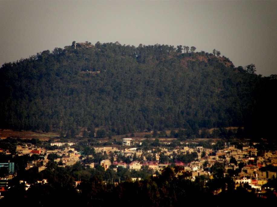
Cerro de la Estrella, Hill of the Star
Called Huizachtecatl (in Náhuatl) by the Mexicas.
  • Mexico City Architecture: This group of pages focuses on the architectural qualities which predominate, particularly in the Cento Historico of the city, the original Ciudad de México which Hernán Cortés began to build on top of the indigenous altepetl, México-Tenochtitlan of the Mexica.
  • Grandeza Mexicana: Grandeur of Mexico CityWalking the streets of Mexico City, from its Centro Histórico to various of its late 19th to early 20th century colonias, (planned neighborhoods) and modern boulevards, acquainting ourselves with their architecture and public art, we have noted the recurrence of what becomes a visual theme: an architectural grandness that relays a message of wealth and power. This city has been, and is, a seat of major political and economic power, expressed through physical grandeza, grandeur. Here we explore the particularly Mexican roots of this impulse to grandeur.
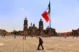
Zócalo
Main Plaza

second largest plaza in the world, 
after Red Square in Moscow.
  • México Barroco | Baroque Art: Representing Divine Ecstasy, Evoking AweIn Mexico, the art of the Baroque epoch (mid 17th to mid 18th centuries) is all around you in Centro and in many of the old churches throughout the city. It is the art of the height of the Spanish Empire, and it realized its most elaborate form in Nueva España. An excellent Wikipedia article on the Baroque helped us see its character as centered on grandeur, lavishness, and drama. We also came to realize the goal of its religious forms was to express holy ecstasy (stepping outside the ordinary world) and evoke awe. With that perspective, we explore the central and quintessential expression of Baroque religious architecture in Mexico City, the Metropolitan Cathedral. There are innumerable other examples in churches around the city.
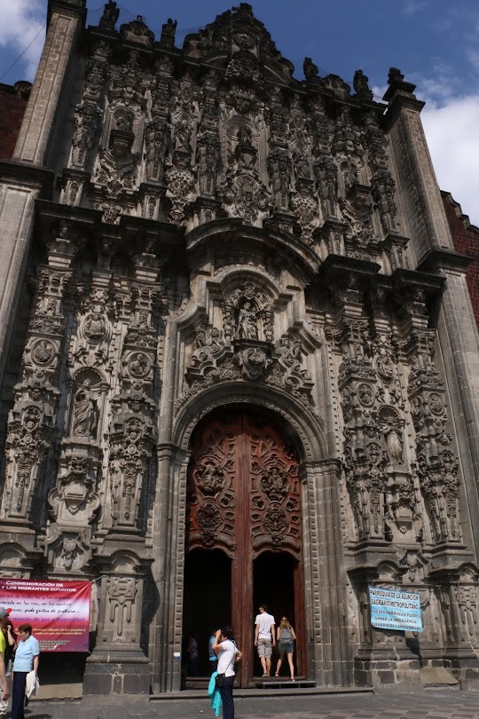
El Sagrario
The Tabernacle portion of
the Metropolitan Cathedral,
in high Baroque style

IV. Thematically or geographically related pages

  • Mexico's History As Embodied In Mexico City: Lists and links to all posts addressing the many stages in Mexico City's history as they are manifested in the cityscape, from the indigenous reign of the Mexica/Azteca through the Spanish colonial period (1521-1821), and the 19th and 20th centuries, up to the Mexican Revolution (1910-17) and its aftermath. 
Chapultepec Castle,
scene of several significant events
of the 19th century.
  • Mexico City's Original Indigenous Villages and Their Spíritual ConquestContemporary Mexico City is an amalgam. It's core is the Spanish Colonial Centro. It did not significantly expand beyond that until the late 19th century. Then, in the second half of the 20th century, it exploded with rapid urbanization of previous lakebed and rural land. In that relatively recent explosion, it swallowed up ancient indigenous pueblos. These are villages, that, beginning some three thousand five hundred years ago, were established on the shores and islands of the five lakes at the center of the Valley of Anahuac. So Cortés and the Spanish not only had to transform Tenochtitlan, they also had to transform a geographically extensive civilization and culture via the "evangelización de los indios," or "los natuturales", what has been called the Spiritual Conquest. This series of posts explores the churches, neighborhoods and fiestas that continue to embody that encounter and the synthesis of the two civilizations. (This is our current work-in-progress).
Original, 16th century chapel of San Francisco,
in Quadrante (Quarter) of San Francisco,
originally the indigenous village of 
Hueytetitlan, now in Delegación Coyoácan.

  • Centro: El Centro, the Center of Mexico City, actually consists of five colonias, or neighborhoods: Centro Histórico, and East, West, North and South Centro. Spanish colonial palaces and smaller residential and commercial buildings from that period are numerous, but mixed in among them are buildings from the 19th and 20th centuries. Within them, and flowing among them in the streets, is the everyday, timeless activity of selling and buying.
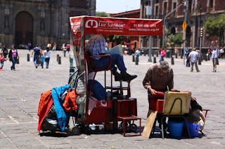
Portable shoeshine stand
in Plaza 
de Santo Domingo
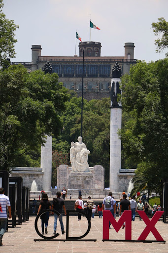
  • Chapúltepec Woods and Paseo de la Reforma: Five kilometers, three miles, southwest of Centro, on what used to be the western shore of Lake Texcoco, sits the ancient, sacred site of el Bosque de Chapúltepec, Chapultepec Woods. It was the first place that the Mexica/Azteca tried to settle down near the end of the 13th century, and later their royal retreat and source of fresh spring water for Tenochtitlan. The Spanish turned it into a park for themselves and continued to depend on its freshwater springs. 
Subsequently, a "castle", actually a palace, was built by a viceroy (ruling representative of the king of Spain) at the top of its landmark hill, an ancient ash cone volcano. After Independence was won from Spain in 1821, it served as the Mexican Military Academy and, in 1847, it was the scene of the last battle in the U.S. invasion of Mexico (aka Mexican-American War). In 1864, Emperor Maximilian I, put in place by Napoleon III of France at the request of Mexican conservative forces, decided to make it his palace. To connect it with the City Center, he had a boulevard built and named after his wife the Belgian Princess Carlotta. After his overthrow by liberal reform forces led by Benito Juárez in 1867. it became Paseo de la Reforma.
Paseo de la Reforma,
seen from Chapultepec Castle
  • Reign of Porfiro Díaz and Neighborhoods of the Early 20th Century: As the 19th century approached its end, Mexico City's well-to-do, who had increased in numbers under the economic policies of Porfirio Díaz (multiple times reelected president and dictator from 1876 to 1911), sought new residences outside the old Spanish Colonial Centro Histórico. They began to develop colonias, planned neighborhoods, to the west, along Paseo de la Reforma boulevard, and to its north and south. Díaz and the well-to-do had a great admiration for French culture. Hence, these colonias have a French flavor. Posts on six of these neighborhoods, with introductions, are listed.
French Second Empire-style homes,
with characteristic mansard roofs.
  • Mexican Revolution: Overview of Its Actors and Chapters: The Mexican Revolution (1910-1917) was a watershed between traditional and modern Mexico. Actually, a series of four civil wars fought between a diverse cast of characters with widely disparate histories and motivations, the war and its turbulent aftermath can be divided into five stages or chapters, each consisting of a number of critical episodes. This Page offers an overview of the war and links to Pages with fuller accounts of the personalities and each chapter of the war and its volatile aftermath.
Monument to the Revolution
  • Mexican Muralists: During the Mexican Revolution, a revolution in Mexican Art was triggered. After the Revolution, it unfolded in a group of buildings in Centro and expanded across the city throughout the 20th century. This page provides links to posts on the sites and their murals—works by the "Big Three": Diego Rivera, José Clemente Orozco, David Alfaro Siqueiros, and their successors, who continue to produce works up to the present.
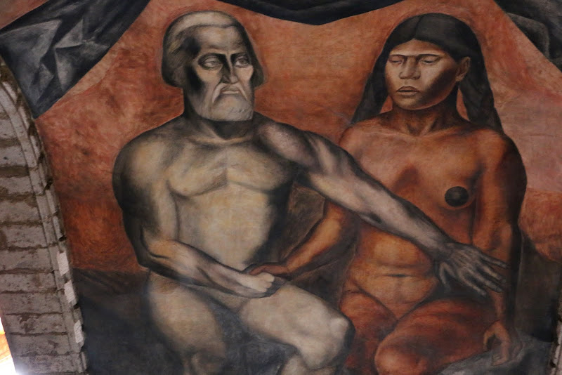
Mural of Cortés and Malinche,
representing the mixing (mestizaje)
of Spanish and indigenous peoples.
by José Clemente Orozco,
in the museum San Ildefonso.

Tuesday, October 26, 2021

Mexico City's Green Spaces | Parque Masayoshi Ohira

Today, we visit a park very near where we live in the Borough of Coyoacán. It is the Parque Masayoshi Ohira, a Japanese garden that was created, surprisingly, in 1942 as a symbol of Mexican-Japanese friendship. There have been Japanese living in Mexico since the Colonial Period, but most have immigrated since the late 19th century.
 
The park was originally known as "The Pagoda Park" because of its original, predominant pagoda, which, unfortunately, burned down in the 1970s. 

The original pagoda

In the 1980s, it was renamed after Masayoshi Ōhira, the first Japanese prime minister to visit Mexico, who came in 1980 and died shortly afterward. It has been renovated a number of times, most recently in 2014, with the financial support of the Mexican-Japanese Association.

Although we have wanted to visit the park for some time, because it is across the Calzada de Tlalpan, a major highway with few crossings, it seemed difficult to access. But now that we can go back out into the city again, at least to open spaces, we decide to take another look at the map. We find that a pedestrian bridge only two blocks from our apartment crosses the Calzada and from there it is only a four or five-block walk to the park, less than half a mile. So one fine autumn day, off we go. 

Arriving at the park, which fills less than a city block, we circle around until we find the main entrance. It is dramatically framed by a torii, a gateway of red posts and a black top. Such torii are the traditional entrance to every Shinto shrine, marking the threshold between secular, everyday space and sacred space.

Torii gate at the entrance to Parque Masayoshi Ohira

Entering through the huge torii gate, we can see a pond in the distance, with two bridges and another torii gate, this one standing in the water. A number of dirt pathways lined with stone lead from the gate in various directions.

For some intuitive reason, we take a path to the right, towards the north end of the park and the pond. The path wanders gently from right to left and back, creating the feeling of a relaxed amble, just the experience we seek!

Soon, we arrive beside a paved square at the side of an opening in the stones that line the path. Clearly, it designates a vantage point for viewing the pond and the park around it. In the foreground is a gently arching, green, iron bridge. Near the middle of the water of the pond is the second torii arch. Beyond it, crossing a narrow branch of the pond, is a classic Japanese, bright red, bow bridge.

The whole composition communicates the tranquility of the traditional Japanese garden. It is definitely a place to escape the city's noisy bustle, a place to rest, to feel in contact with a miniature representation of the natural world, a place to regain contact with the center of one's own self.

The pond with its bridges and torii,
the threshold between the mundane and the spiritual.

At this moment, two young women walk up onto the green bridge. They stop to soak up the tranquility in the cooling shade falling on the bridge.


Now, we walk down the western side of the pond and have a serene view of the green bridge at the north end.


As we near the southern end, we get a good view of the torii gate standing in the middle of the pond.


At the southern end, we get a full view of the pond, with its red bow bridge in the foreground, the torii in the middle of the water, and the gentle green bridge in the shade at the north end, where we began our walk.


In classic Japanese style, the park recreates an enclosed, miniature, natural world with the simple but central elements of water, stones, plants and trees. Also, today, above the circle of evergreen trees, the sky provides a pure, intense blue ceiling, which completes the feeling of being totally embraced by Mother Nature.

In our private center, we feel the tranquility that this exquisite, archetypical design induces. We do not want to leave, but the world's agenda awaits us. We turn towards an exit, pledging to ourselves that we will come back other times, especially when we need an infusion of nature's tranquility.

Tuesday, July 7, 2020

In Mexico City, the Coronavirus Is Bringing Back Thousand-Year-Old Indigenous ‘Floating Gardens’

Atlas Obscura, June 25, 2020 | By Amanda Gokee*

Business is booming for farmers who plant on man-made islands


A man uses a "trajinera" — a traditional flat-bottomed river boat — as transport in the Xochimilco natural reserve in Mexico City. Credit: Ronaldo Schemidt / AFP via Getty Images
In the south of Mexico City, about 100 miles of murky canals wind their way through the Xochimilco alcaldía (borough).
Here, the urban sprawl of one of the world’s densest cities yields to a lake region where indigenous farmers have been cultivating a unique system of floating gardens for over one thousand yearsCalled chinampas, these floating gardens were built by the Xochimilcas to feed a growing population
MCA Note: Around 900 CE, the Xochimilca people, considered one of earliest of the seven Nahuatl-speaking tribes to migrate into the Valley of Mexico, settled on the south shore of the lake that would come to bear their name. It was the southernmost lake, along with Lake Chalco, of the five lakes nearly filling the valley. Their first chief was Acatonallo, who is credited with inventing the chinampa system, which greatly increased crop productivity. These chinampas eventually became the main producer of crops of corn, beans, tomatoes, chili peppers and squash in the Valley of Anáhuac.
The altepetl, city state, of Xochimilco was founded in 919 CE. Over time, the city came to dominate other areas on the south side of the lake and across the mountains to the south, in what is now the State of Morelos. In 1352, the tlatoani, "speaker", Caxtoltzin moved the city from the mainland to the island of Tlilan.
In 1376, the Mexica (aka "Aztecs") who had established their city of Tenochtitlán in 1325 on a group of islands in Lake Texcoco, attacked Xochimilco, forcing the city to appeal for help from Azcapotzalco, the Tepaneca power on the west side of Lake Texcoco. The attack was unsuccessful, but Xochimilco then became a tributary of Azcapotzalco.
The Mexica finally conquered Azcapotzalco in 1428 and conquered Xochimilco in 1430. Shortly thereafter, the Mexica huey tlatoani, "chief speaker", Itzcoatl built a causeway south across the lake to Coyoacán on the southwest bank and Culhuacán on the Iztapalapa Peninsula which separated Lake Texcoco from Lake Xochimilco. This also create a land route from the island of Tenochtitlán to Xochimilco via Coyoacán. At that time, Xochimilco became a major supplier of produce to Tenochtitlán. 
When Hernán Cortés led his Spanish soldiers and indigenous allies into the Valley in 1521, after being driven out in June 1520, the Mexica rulers of Xochimilco resisted. So, Cortés decided to attack the city before his final assault on Tenochtitlan. Using indigenous allies, he attacked on April 16, 1521. Although Cuautémoc, the last Mexica tlatoani, sent ten thousand warriors by land and two thousand by canoe to defend the city, the Mexicas and Xochimilcoans were defeated.
Subsequently, Mexico City was built on top of the ruins of Tenochtitlán. The Spanish then undertook a massive project of draining Lake Texcoco to prevent flooding of their island city, but to keep a route for continued water transport of produce from Xochimilco to Mexico City, they created a canal, called the Royal Canal. After Mexican independence in 1521, it became the National Canal. It remained in use until trucks replaced canoes in the 1920s. Wikipedia
Xochimilco became one of the city’s main sources of food, but rapid urbanization in the 1900s meant less land available for farming.
In 1985, when an earthquake struck Mexico City, many chinampas were abandoned as people who had lost their homes built shanty towns on themToday, only an estimated 20 percent of the approximately 5,000 acres of chinampas are in use, and only 3 percent are used for farming.
But since the COVID-19 pandemic hit Mexico, interrupting the industrial food supply in important ways, small farmers have increased production and rehabilitated abandoned chinampas to fill the demand for fresh, local food.

Raúl Mondragón (left) and Pedro Capultitla (right) covering a chinampa in dried grass for mulch. Courtesy of Colectivo Ahuejote (Ahuejote is the tree Salix bonplandiana (Bonpland willow) native to southern and southwest Mexico and planted around the edge of chinampas to hold their soil in place.)
Raúl Mondragón says on a Zoom call from his home in Mexico City:
“We’re talking about something that’s 1,000 years old. We have to preserve this.” 
Mondragón has been recuperating chinampas since 2016, when he founded Colectivo Ahuejote. Now the virus is revealing the strength of this model in the midst of a crisis.
The revival of chinampa farming is due, in part, to pandemic-related problems at Mexico City’s main market, La Central de Abastos, the largest of its kind in Latin America.
Some warehouses have closed, truck traffic has been limited, and people have been getting sick with the virus. The supply chain of producers from around the country has also had to contend with road closures that limited deliveries to the capital and raised prices.
Mondragón and Capultitla taking in a harvest of kale (left) and a chinampero farmer holding a colorful array of carrots (right).Courtesy of Colectivo Ahuejote

While the market is an enclosed and often crowded environment, small farmers can deliver their crops to the consumer directly, using a model similar to Community Supported Agriculture [CSA].
At a time when people are worried about the risk of shopping at a crowded market or grocery store, buying directly from a chinampero, parked with his truck at an outdoor pickup point in their neighborhood, is one way of limiting exposure.
Quarantine has also given many Mexicans more time to cook, Mondragón points out, and they are taking a greater interest in where their food comes from.
He cites a friend who now not only knows what a leek is but also how to cook it. His “very capitalistic” sister has started compulsively composting.
At a Colectivo Ahuejote workshop, farmers use a kassine tool to till the soil. Courtesy of Colectivo Ahuejoten

Mondragón grew up in Xochimilco, eating produce from the chinampas that his family bought at a local market
.
Now he works on the 16,000-square-foot chinampa that Colectivo Ahuejote uses for growing crops, teaching, and experimenting with new techniques. 
The collective operates as an NGO to develop cooperation among farmers, and they’ve also started a for-profit business to sell produce. 
Their goal is to rehabilitate abandoned chinampas to promote sustainable agriculture and the country’s agricultural heritage.
The pandemic halted the collective’s workshops and training activities, but the commercial side of the business has been flourishing.
Between February and May, small farmers who are part of the collective have increased sales by 100 to 120 percent, according to Mondragón. Networks that have been years in the making are now becoming a bigger part of the city’s food supply.
Fennel, broccoli, and quelites (native greens to Mexico that often grow wild) growing in a chinampa
Courtesy of Colectivo Ahuejote

This is a welcome change for farmers who have other jobs to support themselves.
Chinampero Pedro Capultitla used to have two or three extra jobs, but he was able to quit one recently to spend more time farming.
The word chinampa comes from the Nahuatl chinámitl, meaning a hedge or fence made out of reeds.
Mud from the bottom of the canal as well as lake vegetation are piled into this fencing until they reach the surface, creating a fertile and well-irrigated place for crops to grow. These favorable conditions make the chinampas one of the most productive types of agriculture in the world, enabling as many as seven harvests per year.  
A variety of produce flourishes here:
greens, herbs, flowers, fruits, and milpa — a combination of corn, beans, and squash also grown by Native American farmers in the United States, who call this collection the three sisters.
Chinampero Pedro Méndez Rosas has been farming his whole life, and in that time, he’s seen generations of farmers leave to find work in the city.
“They go in search of more money, or a more elegant life,” he says on a phone call after a day spent mostly harvesting squash. 
“But I’ve always preferred to be in the field.”
Pedro Capultitla’s son, Axel, navigates a trajinera on a canal in Xochimilco. Axel is a 6th-generation chinampero
Courtesy of Colectivo Ahuejote

Méndez Rosas farms the same chinampas as his father and grandfather, and he eats the food he grows there, only buying products like grains and meat
.
He started helping out when he was 5 or 6, and “really working” when he was 13. This October, he’ll turn 50.
Since COVID-19, Méndez Rosas has seen the demand for leafy greens go up.
As the orders he normally fills from restaurants and chefs have been put on hold, he is now primarily selling products to individuals and families. The quick changes to business can be challenging, but Méndez Rosas has never been in it for the money.

“Being a chinampero is a vocation,” Méndez Rosas says. 
“For me, it’s a way of life. It’s a way of hanging onto our traditions and our culture.”
These floating gardens have been feeding the city for a millennium, in times of sickness and in times of health, and this pandemic has made it clear that they are poised to keep sustaining the city in the future.
Traditions continue quietly; a seed buried in fertile ground, small certainties against the future. For his part, Pedro Méndez Rosas prepares, again, to plant.
+   +   +

*Amanda Gokee is a Jewish/Ojibwe writer interested in food systems, food sovereignty, and the connection between plants, people, and places.

Saturday, April 18, 2020

Mexico City's Flowers

In our ambles through the colonias, pueblos and barrios of Mexico City, we have been focused on the important buildings, primarily the original 16th-century churches built by the Franciscans or other orders of monks, and most of all on the people and their celebrations of their traditional fiestas.

However, also being a gardener, we have taken photos of the many kinds of flowering plants, vines, shrubs and trees that lend the beauty of nature to the city's neighborhoods, particularly their plazas and the atriums of their churches. There are also many parks. So, in this time of confinement, when we cannot take ambles, we thought we would present our collection of flower photos.

Hibiscus

Southern Mexico does not really experience distinct seasons, except the "dry season" of winter to mid-spring and the "wet" season from May through September. The somewhat cooler temperatures of "winter" (daytime highs of high 60s to low 70s) are an indistinguishable blend of what, in the northern U.S. is early fall with late spring. Deciduous trees don't all lose their leaves at the same time in October. Each one has a "fall" of its leaves in a sequence between October and February, and its "spring" of new leaves within a month of the "fall". Therefore, we call this "season" "Fling", a merger of fall and spring.

Canna lily

As a result, there is no clear season for flowers, except for some that like the dry time for blooming while others like the rainy season. Thus, there is no clear order in which they bloom. Roses bloom in the midst of winter and poinsettias bloom from November through April. Hence, our presentation has no chronological order that a northern gardener would be able to display.

In any case, we hope you enjoy the flowers of Mexico City. Interestingly, many come from other tropical climates: South America, Southern Africa and Southern Asia. So the tour is also a botanical tour of these other continents!

Jacaranda  (hah-kah-RAHN-da) tree

I have placed the flowers in a Google Photo Album, Flowers of Mexico City. Clicking on the link will take you there. Then click on the first photo to enlarge it. In the upper right-hand corner is an icon consisting of the letter 'i' in a circle; clicking on it will open a sidebar of information about each flower. I have done my best to identify each one, but there are several I haven't been able to. Enjoy!

Rose

San Francisco Tlaltenco, Tláhuac | Carnaval of Disguises and Faces

San Francisco Tlaltenco is one of seven originally indigenous pueblos in the Delegación/Alcaldía of Tláuac, in southeastern Mexico City. Until the latter part of the 20th century, it was still rural, with residents raising crops on chinampas, man-made island gardens in the former Lakes Xochimilco and Chalco. San Francisco Tlaltenco was originally on the south side of the Iztapapalpa Peninsula, on the north shore of Lake Xochimilco. Some chinampas and remnants of Lake Chalco still exist in eastern Tláhuac. (See our post: Tláhuac: Crossroads Between Two Lakes and Two Cultures.)

Each spring, during the Catholic season of Lent, between Ash Wednesday and Holy Week, many of the pueblos in Tláhuac and its neighbor, Delegación/Alcaldía Iztapalapa, hold Carnavales. They can be extended over several weeks, with various comparsas (troupes of parade dancers) marching through the streets each weekend, accompanied, of course, by the music of brass bandas.

Carnaval in San Francisco Tlaltenco


We have been to four of the other pueblos of Tláhuac, usually for their patron saint fiesta or some other fiesta. We haven't been to one of their Carnavales, so we are doubly eager to get to the one in San Francisco Tlaltenco. It turns out that this weekend is devoted to a parade of comparsas de disfraces, of disguises.

Arriving via taxi from the nearby Tláhuac Metro Station to a corner where the Carnaval's Facebook page says it will pass, we find it is in front of a small chapel where mass is being held. In the blocked-off street, people are standing or milling about, some are wearing disguises of all types: princesses, Aztec death warriors, chinelos (Moorish-style costumes), space creatures, cartoon characters. It´s quite a conglomeration. We wait un rato, a while, before anything happens.

Then, suddenly, a banda appears and begins to play. Apparently, the parade is about to begin.

Lower Left is the shirt of a committee member of the Comparsa (parade troupe)
called los Cupamaros (cupar is to suck, a maro is the seed of a lavender plant
considered medicinal).
Second from bottom right is a chinelo, a frequently seen style of parade comparsa
in Mexico City and in the State of Morelos, where they are said to have originated to spoof the Spanish.

Egyptian Princess

Anubis, Egyptian Dog God of Death and the Underworld
A large float appears, decorated with peacocks, a favorite symbol of royalty. A beautiful young woman with flowing blond hair, dressed in a sequin-covered evening gown and crown is assisted in mounting a tall podium from which she will preside over the parade. 


Princess Dayan (Dah-yahn)
Dayan tosses candies to the crowd.

The Parade Gets Underway


A  golden angel leads the way.

Followed by esqueletos, skeletons.
The vivid contrast of eternal life and death is a central theme in Mexican culture
.

One esqueleto is holding a michelada, a beer with chile added and salt on the rim.
The salt actually cuts the picoso or piquante hotness of the chili.

A large float appears, decorated with peacocks, a favorite symbol of royalty. A beautiful young woman with flowing blond hair, dressed in a sequin-covered evening gown and crown is assisted in mounting a tall podium from which she will preside over the parade. 

There is a Greco-Roman god, Neptune, and an indigenous one.
The jaguar is a traditional indigenous symbol of the sun god at night,
on his journey through the Underworld.

comparsa with more explicit and elaborate Mardi Gras-style Carnaval disfraces is next. 


Then some more ominous figures, including the appearance of two angels of death.


They are followed by some comic relief.


Then there are the inevitable vaqueros, cowboys.


This is a charro (fancy-dressed cowboy) of death.
We have seen many fiestas
with large comparsas of such charros.

More death, but in more ordinary vaquero dress.

Then another dramatic change of theme:

Two Hydras.


Followed by some sci-fi figures.


Finally, just sheer beauty!


We feel like we have been at a Halloween parade, with the wide variety of disguises presented. But this is springtime Carnaval, when Mexicans can discard their ordinary identity and disguise themselves as anything they wish to represent, be it angels of light or darkness, monsters or Greek gods, cowboys of death, cartoon figures, sci-fi heroes, or princesses. Their imagination and inventiveness is remarkable. 

When the parade is over, happy that we have come to San Francisco Tlaltenco for this holiday from daily routine, we hail a cab to take us back to the Tláhuac Metro station and la cotidianidad, daily life. 

Delegaciones or Alcaldías of Mexico City
Tláhuac is the dark brown one
in the southeast. 

Seven Original Pueblos of Delegación Tláhuac
(Each pueblo is divided into various barrios)

San Francisco Tlaltenco (red/yellow star) is in the northeast corner.

Gray-green areas marked by rectangles are chinampa fields.
Other gray green areas to the north and south are volcanic mountains.
A remnant of Lake Chalco remains to the east.